
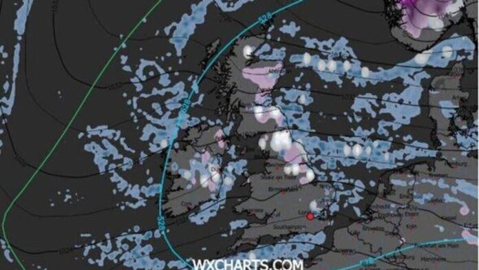

Britain is likely to experience a true White Christmas this year, as per the latest weather maps. Snowfall could reach London on Christmas Day, spreading further south than originally expected. New charts from WXCharts show widespread wintry showers across the UK, with snow anticipated from Scotland down to the Home Counties. Recent modeling suggests colder air moving into England, increasing the chances of snow in the capital.
The maps indicate light to moderate snowfall in central and northern areas, with heavier accumulations forecasted over Scotland’s elevated regions. The “528 line” on the chart, a crucial meteorological marker for snow prediction, extends into southern England, enhancing the possibility of snowfall in the southeast during shower activity.
This benchmark helps forecasters anticipate wintry conditions, with regions north of the line likely to see snow and those south more prone to rain. Another WXChart map for Christmas Day shows cold air enveloping northern and central UK, with temperatures near freezing in Scotland, northern England, and parts of Northern Ireland.
Predictions suggest snow flurries or showers across the nation, with higher chances in Scotland, northern England, and Ireland. For London and the Midlands, snowfall possibilities depend on shower timing and Christmas morning temperatures. Settled snow on Christmas Day is expected mainly in the Scottish Highlands.
The Met Office’s long-range forecast for December 16 to December 25 indicates unsettled weather initially, with rain affecting the UK, especially in the west and northwest. Snow is likely only on high ground in the north. Later in the period, conditions may become more settled, with decreased rainfall and potential overnight fog and frost.
The Met Office warns that predicting snowfall is challenging due to minor variations in weather elements. It’s essential to note that snowfall forecasts can change, especially as the date approaches.