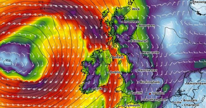
The Met Office has issued an urgent weather warning due to the expected arrival of gale force winds. The weather agency has cautioned the public to prepare for potential power outages following the alert for severe wind conditions. Wind speeds could reach up to 70mph, classified as gale force, and are predicted to sweep through exposed areas, accompanied by heavy rain showers.
Forecasters have raised concerns about possible traffic disruptions and service interruptions in Northern Ireland as Hurricane Melissa threatens to bring similar adverse conditions next week. The warning covers all six counties in Northern Ireland and is in effect from 1pm tomorrow until 11pm.
According to the advisory, south to southeasterly winds will intensify on Thursday afternoon and evening, with gusts ranging from 40 to 50 mph expected widely, possibly reaching 60 to 70mph in more exposed regions, particularly along coasts and over the Mournes. Rain showers are also anticipated during this period, with the potential for heavy rain and strong, gusty winds in localized areas on Thursday evening.
The alert follows the Met Office’s caution about Hurricane Melissa, currently active in the West Indies, potentially influencing the UK’s weather patterns and maintaining unsettled conditions. Although there is a slight possibility of Melissa’s remnants affecting the UK’s weather next week, any significant disruptive weather occurrences are currently unlikely. However, the system could contribute to the prevailing unsettled weather conditions across the UK.
The Met Office’s extended forecast spanning November 2 to 11 predicts continuing unsettled and changeable weather conditions. Low pressure systems are expected to bring heavy rain to all parts of the country, with the west likely to experience the most significant impact, including the possibility of further gale force winds. The forecast also anticipates intermittent strong winds, with the potential for gales or severe gales. While some drier and clearer intervals are expected, particularly in the east, these conditions may become more widespread and prolonged towards the end of the forecast period.
With prevailing westerly or southwesterly winds, above-average temperatures are anticipated, reducing the likelihood of overnight frost and fog compared to normal conditions, especially initially.
