
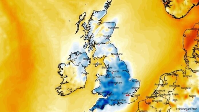

Temperatures are expected to drop significantly nationwide in the coming hours as cold winter air moves in, according to the latest forecasts.
On Tuesday night, weather conditions are predicted to be up to nine degrees colder than the previous night in some areas of the UK, with temperatures dipping below -1C in southern England and hovering just above 0C in central regions.
Widespread frosts are anticipated, and drivers may need to use ice-scrapers before heading out in the morning. Northern areas are likely to experience milder temperatures overnight, reaching around 6C in Ayrshire, Scotland, and 3C elsewhere.
Meteorologist Annie Shuttleworth from the Met Office mentioned the likelihood of a widespread rural frost and highlighted a significant temperature difference compared to the previous night, especially in central England.
While Tuesday may bring some sunshine, the weather is expected to remain unsettled for most of the week. Weather expert James Madden from Exacta Weather predicted snowfall in northern regions later in the week, particularly in higher elevations.
A yellow weather warning for rain has been issued for southwest England and south Wales for tomorrow, with heavy downpours likely to cause travel disruptions and potential flooding.
According to the Met Office, a period of heavy rain, especially over high ground, is expected to move eastward on Wednesday, potentially leading to travel issues and flooding, particularly in Dartmoor and the hills of south Wales.
Patchy rain will clear from eastern England in the morning, with a dry and bright day ahead for many areas, though northwest Scotland may experience some blustery showers. Temperatures will feel colder than recent days.
Wednesday is forecasted to turn wet and windy, persisting into Thursday, before becoming drier and brighter on Friday with scattered showers. Temperatures will be near average, milder in the far south.