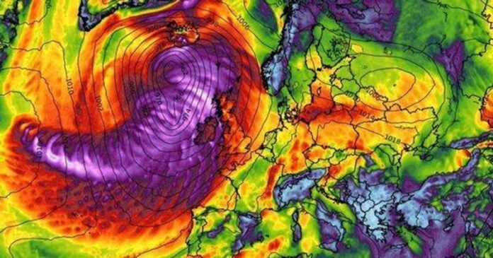
The UK is bracing for heavy rain and strong winds today, as depicted in detailed weather maps. Halloween celebrants are advised to seek shelter as the inclement weather is expected to persist through Saturday morning, particularly affecting northern and western regions. Projections from WXCharts indicate wind speeds of up to 80mph, with coastal areas likely bearing the brunt of the storm.
On October 30, the storm is predicted to hit the western coasts of England and Scotland the hardest, with areas like Dumfries and Galloway, Cumbria, and Northern Ireland expected to be significantly impacted. Even southern regions like Hampshire may experience gusts reaching 70mph accompanied by heavy rainfall, with some areas expecting up to 20mm of rain accumulation, according to forecasts.
Meteorologists anticipate the onset of rainy and windy conditions around 3pm, which could lead to possible delays in road, rail, and ferry services due to the severe gales. Coastal locations are warned of large waves and spray throughout the afternoon and evening.
By 6pm, most parts of the country will be wet, with western Scotland experiencing the heaviest rainfall. The Scottish Highlands are forecasted to receive the most rain during the Halloween evening. This turbulent weather follows a rainy Thursday that saw substantial rainfall in Northern Ireland and Wales.
The Met Office warns of further heavy showers and unsettled conditions, with a likelihood of strong winds persisting into the weekend. While temperatures might be relatively mild, windy conditions are expected. The East of England could see temperatures peaking at 16C today.
Looking ahead, the turbulent weather pattern is expected to continue into the following week, with low pressure systems dominating the UK. The Met Office’s long-range forecast indicates a continuation of changeable and unsettled weather, with western regions likely to experience the highest rainfall and strong winds potentially reaching gale force levels.
