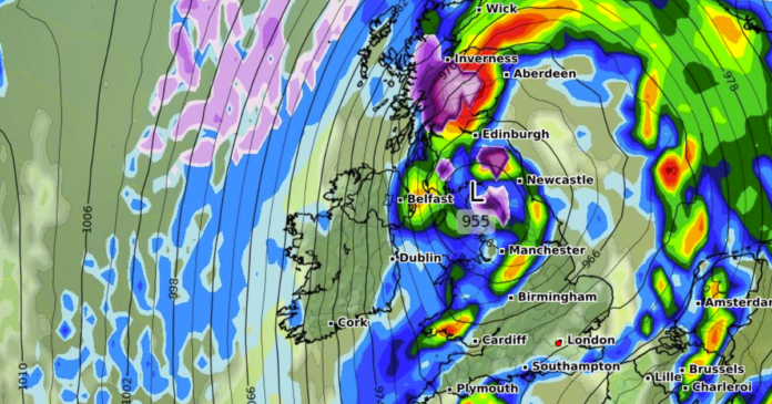
The UK is bracing for a prolonged period of snowfall, with weather models indicating the possibility of blizzards lasting up to six days. The forecast shows that snow is likely to start in northern Scotland on November 9, extending to other parts of the country in the following days. Significant snowfall rates are expected, with regions like the Cairngorms National Park in Scotland and the Pennines in England likely to experience heavy snowfall.
As the weather progresses, snowfall is projected to move across central and southern Scotland on November 11, with cities like Edinburgh expecting flurries. Meanwhile, England and Wales may experience torrential rain during the same period. The most intense snowfall is anticipated in northern Scotland on November 12, particularly in the Cairngorms National Park, with Northern Ireland also likely to see snow showers.
Subsequent days could see scattered snow showers in various cities, including Birmingham, Cardiff, Southampton, London, and Plymouth. While the snowfall intensity may reach 5cm per hour in London, it is expected to be brief, with little to no accumulation on the ground in England and Wales.
Looking ahead, weather forecasters predict a cooling trend across the country from mid-November. The BBC forecasts a shift towards cooler temperatures, with the possibility of drier days but occasional rain showers and windy spells. The Met Office anticipates unsettled weather and frosty nights in the coming days, though snowfall predictions remain uncertain at this stage.
Overall, the weather outlook suggests a mix of snow, rain, and wind in the near future, with temperatures gradually dropping towards average levels as we move into mid-November.
