
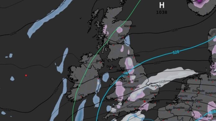

A snowy Christmas is expected as weather forecasts indicate that snow may fall in various regions on December 25. The GFS weather model suggests snow will arrive in the UK from the East on Christmas Day, with areas like East Anglia, the Pennines, and the south-east, potentially including London, likely to experience some flurries initially.
By 6am on Boxing Day, maps show snowfall along the east coast of England, the Midlands, the Peak District, the Pennines, and Gloucestershire. Sporadic snow showers are predicted from Bristol to Lincolnshire around midday on Boxing Day. Snow coverage maps for Boxing Day morning show significant snowfall in Wales, parts of Sussex, and Kent.
The East Midlands, West Midlands, Gloucestershire, Oxfordshire, and Bedfordshire might also see snow, with the Peak District and Pennines in the north expected to be affected. Northern Ireland is forecasted to have no snow, while Scotland may see only sparse coverage over hills.
The Met Office anticipates that temperatures will not drop significantly during the Christmas period. Their forecast for December 21 to 30 indicates unsettled conditions initially, with a transition to drier and settled weather later. Temperatures are likely to be close to or slightly below average, with the possibility of frost and fog becoming more widespread.
BBC Weather forecasts a low chance of a White Christmas for December 22 to 28, with a drier week expected. While some rain is possible in western areas, overall conditions are predicted to be drier than average. Temperatures are anticipated to decrease gradually, with a shift in high pressure potentially bringing colder air towards the end of the week. Snow showers, if any, are likely to be limited to higher elevations, making a widespread White Christmas unlikely.