

Millions of people in the UK are set to experience blizzard conditions leading up to the Christmas period due to an Arctic cold front sweeping across the country.
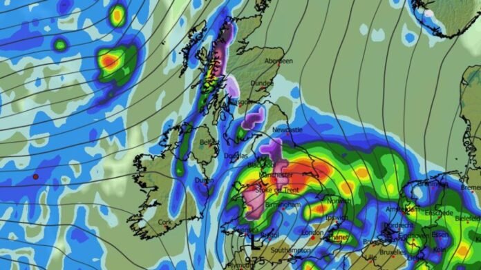
The latest snow forecast maps indicate a shift to icy temperatures and widespread snowfall as the previously mild weather gives way to a chilly spell. Charts from WX Charts have taken on a frosty hue, indicating an imminent snowfall event. The snow is projected to start descending in certain regions as early as Friday, December 19, ushering in wintry conditions.
According to the forecasts, snowfall is expected to commence around 3 am on that day, with Cheshire and the Scottish Highlands likely to be the first areas affected. Subsequent drops in temperature will bring snow to more locations, with regions that miss the snow likely to experience showers instead.
By 6 am, the maps highlight anticipated snowfall of 0.5mm in parts of Scotland and northern England, encompassing Manchester and Stoke. Meanwhile, areas stretching from Birmingham to London are expected to receive rainfall, with Bristol also predicted to be wet.
Moving forward to 9 am, the snow showers are predicted to progress towards the west coast, targeting locations like Blackpool, Yorkshire, and areas north of Glasgow for heavy snowfall. The Arctic front is also forecasted to sweep over Gwynedd in northwest Wales and the Vale of Glamorgan in southeast Wales. Simultaneously, rain is forecasted to reach Birmingham, Merseyside, and the east coast of England.
By 3 pm, the maps suggest that snow will persist in northern England, Wales, and northern Scotland, although its likelihood of accumulation remains uncertain as significant rainfall is also expected during the same period.
Subsequent maps from WXCharts indicate that snowfall will extend as far south as Devon in southwest England, potentially causing travel disruptions on December 20. Following this wintry spell, temperatures are anticipated to rise above average for the time of year.
The Met Office’s outlook for the upcoming period suggests a continuation of the weather pattern observed in early December, with frontal systems from the Atlantic affecting the UK intermittently, interspersed with brief dry intervals.
Despite recent mild weather with strong winds and heavy rain, temperatures have remained above average this week, exceeding 14°C in Teddington, southwest London, and Chelmsford, Essex. The balmy conditions persisted even during Storm Bram on Tuesday.
Looking ahead to December 13 to December 22, the Met Office warns of a potential slight temperature decrease, especially in northern parts of the UK, where wintry conditions may become more prevalent at times.
Initial odds for a white Christmas were at 5/4, favoring Aberdeen for significant snowfall. However, the odds have since shifted to 7/4 for most of Scotland and up to 8/1 for parts of England, including sections of London.